Company Activity
At Jones, we recognise the growing awareness around the demand for responsible business behaviour with issues relating to sustainability, ethics and respect for all of our stakeholders. We are extremely passionate about culture, diversity and inclusiveness in the workplace and recognise the impacts that they have on both their environment and the society in which they operate.
Filter posts by category
NavVis VLX3 Mobile Mapping System
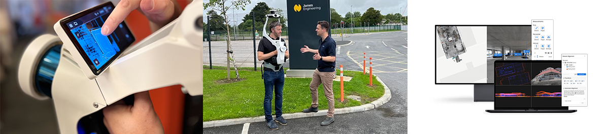
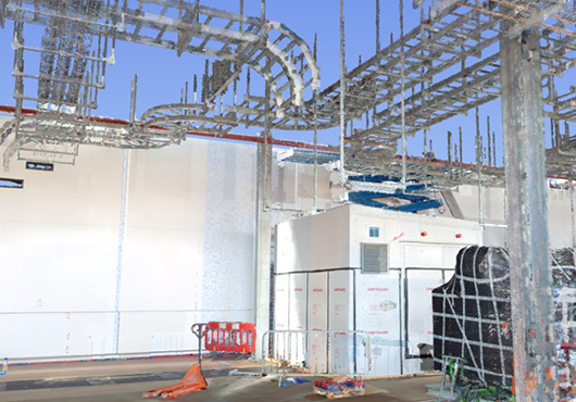
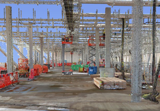
Jones Engineering has recently invested in a NavVis VLX3 Mobile Mapping System. This is a significant move for the company’s Geo-Survey Division, as it will make laser scanning more accessible to sites due to faster data collection, faster data delivery and reduced costs.
NavVis VLX 3 is the industry-leading, wearable mobile mapping system that efficiently delivers comprehensive, highly detailed reality capture data for complex sites, both indoor and outdoor, so you can scan more at scale.
A first-of-its-kind wearable device which enables operators to comfortably scan at the speed of walking, NavVis VLX 3 is powered by precision SLAM technology.
This month the mobile mapping system was put to the test at a confidential site in London and it was a great success. One of the benefits with the NavVis VLX 3 is the improved speed that point cloud data can be recorded for an area. What would usually have taken three days (with a terrestrial laser scanner) took 3 hours on site with this system.
With multiple methods of transporting NavVis VLX 3, moving around and between sites has never been simpler. A protective, hard-shelled case on wheels enables air and rail travel, allowing our professional geo-surveyors to travel to and from domestic and international sites safely, quickly and with unprecedented efficiencies.
This innovation will be available to all Jones Engineering clients including those in the following sectors: data centres, life science, semi-conductor, industrial, commercial, healthcare, food & beverage, renewable energy, etc.
Jones Engineering Geo-Survey Manager, Rob Hughes, explains: “With the NavVis VLX 3, the future of mobile mapping certainly has arrived. This investment will be a game changer for us, with accelerated turnarounds while maintaining incredible data standards. Adding this technology to our existing suite of services including terrestrial laser scanning, hybrid laser scanning, drone LiDAR, etc, will enable us offer unrivalled data quality to our clients.”
For more information, please contact rhughes@joneseng.com or info@joneseng.com